

The wars in Utsunomiya
The Boshin War broke out between the new government army and the old Shogunate force in January, 1868. Some of the old Shogunate forces continue resistance even after the bloodless surrender of Edo-jo Castle. On April 19, the old Shogunate forces invade Utsunomiya-jo Castle from its southeastern direction, while the Utsunomiya Domain of the new government side defends against, but is pushed back by the old Shogunate forces, ended up with setting fire to the Ninomaru building or the outer citadel and leaving the castle. Most of the Utsunomiya-jo Castle town are destroyed by fire, combined with the fire cast by the old Shogunate party. 4 days later on the 23rd, the old Shogunate forces which once occupied Utsunomiya-jo Castle, faced an all-out attack by the new government army, and retreated all at once, heading for Nikko.
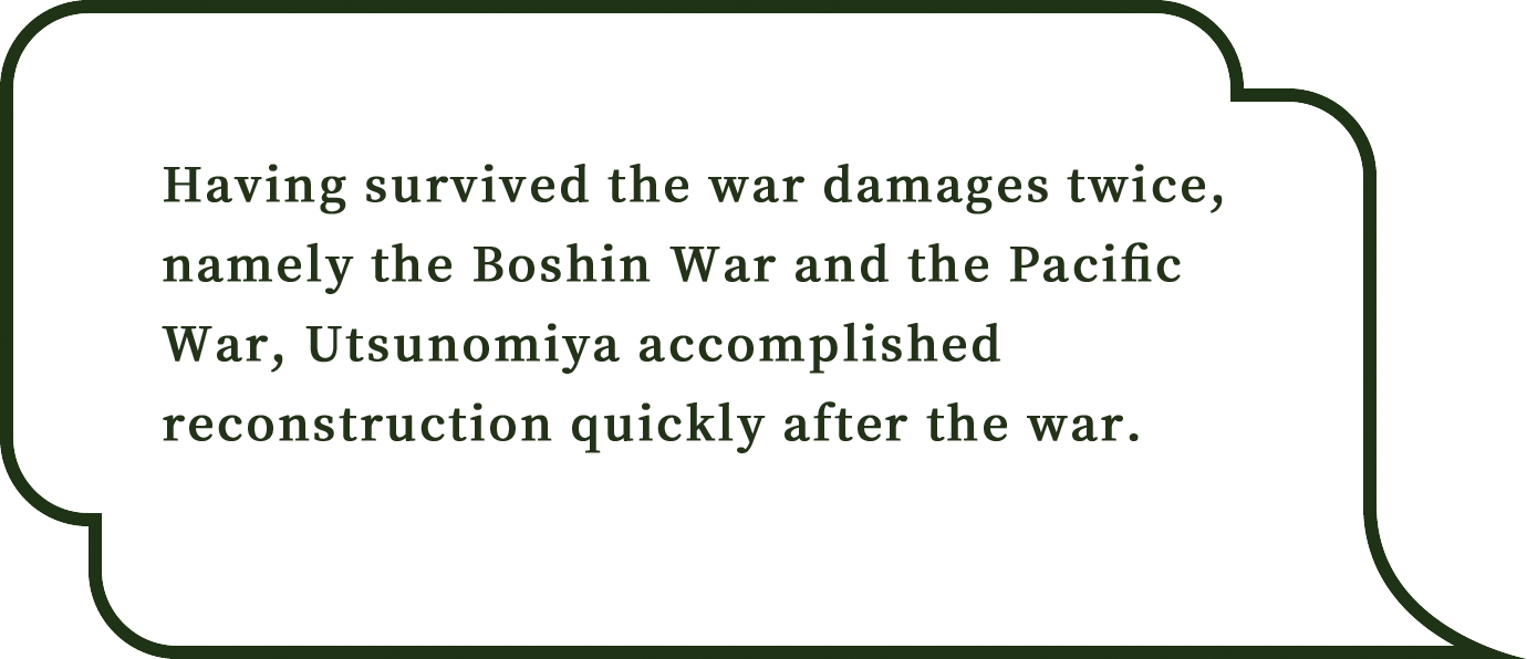
A drawing of the Boshin War Utsunomiya-jo Castle Battles
While offensive and defensive battles were carried out over Utsunomiya-jo Castle, too, the castle was occupied by the old Shogunate forces at one time. Due to this war, most of the castle town were destroyed by fire, including Utsunomiya-jo Castle and Futaarayama-jinja Shrine. This figure draws the 2 battles over Utsunomiya-jo Castle in the Boshin War. (City-Designated and Komyo-ji Temple Owned)
Birth of Prefectural Capital Utsunomiya
Once turned out to be a burnt field in this war, the town of Utsunomiya experiences a wave of the later westernization, and gets reborn as a modern town. Further, by a move of the prefectural office from Tochigi to Utsunomiya in 1884, it starts to play a key role of politics and economics of the prefecture both in name and reality.
Military capital Utsunomiya
The military-related facilities such as the divisional headquarters, etc. were placed in Utsunomiya when it was assigned as a garrison of the 14th army division in 1907, and Utsunomiya came to become a town of “a military capital” to carry an important role of a national defense.
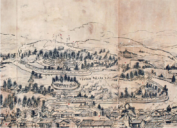
Utsunomiya Chuo Girls’ Senior High School Red-brick Warehouse (The old 66th Infantry Regiment Warehouse)
Along with the 14th division established in Utsunomiya in 1907, it was built as a kitchen-related facility of the 66th Infantry Regiment, and is now used as a multi-purpose hall. (Government-Registered)
Most of the former city area burned down
On July 12, 1945 when the Pacific War was coming to an end, the B-29 bombers of the U.S. forces flew over the sky of Utsunomiya and dropped firebombs. The most of the former city area became a burnt field, causing many casualties and serious damages.
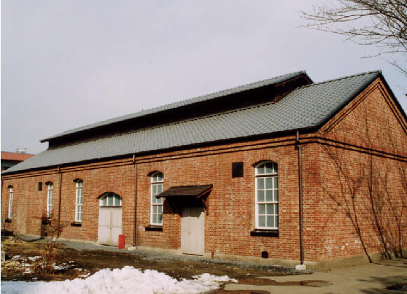
The city area destroyed by fire in the Utsunomiya air raid (Photographed by Midori Nakajima)
At 23:19 on July 12, 1945, the U.S. B-29 bombers started the Utsunomiya air raid. It was not a specific military target including a military equipment factory and an airports, etc., but the city area where the general public lived, that was aimed at.
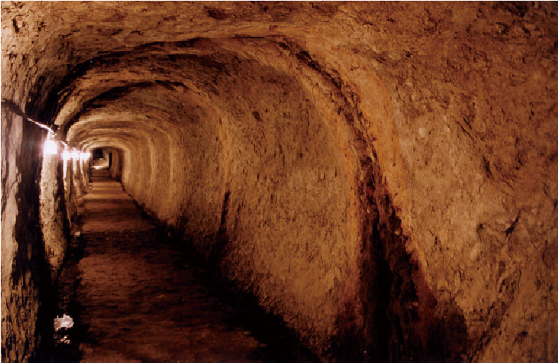
Bunker of Hachiman-yama
In 1945 toward the end of World War II, the army built a bunker, assuming to use it as underground headquarters in preparation for the coming air raids and decisive battles in the mainland. The war ended before its completion, and the bunker was not really used. (Not open to the public now)
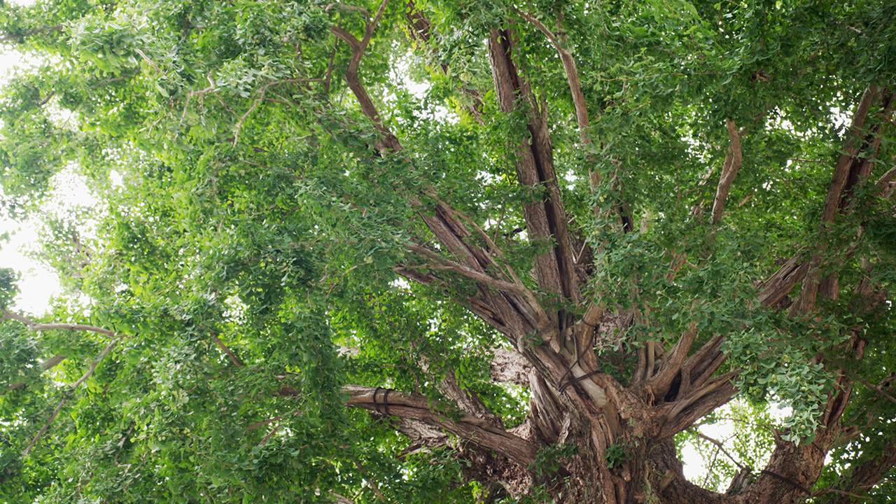
Symbol of the postwar reconstruction “The big ginkgo tree”
Utsunomiya accomplished its reconstruction quickly after the war. While Utsunomiya was burned out by the air raid then, “the big ginkgo tree of Asahi-cho”, which continued standing on the earthwork of the Sannomaru, let the new buds sprout in the next year after the war, and served as emotional support by providing courage and hope to the citizens.
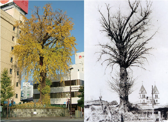
The big ginkgo tree
A photograph on the right is the big ginkgo tree that remained in the burned ruins. A bud sprouted to have grown into the current figure. (City-Designated)